Sharing PARCEL VIEWER
 Video Demonstration ▶️
PARCEL VIEWER has built-in tools that provide the user with new ways to collaborate with others in analysis and planning. We know that when dealing with land based projects our users are not working alone, but must collaborate and share information with others. Giving users the ability to share their map views and access to tools freely with others is something that is unique to PARCEL VIEWER.
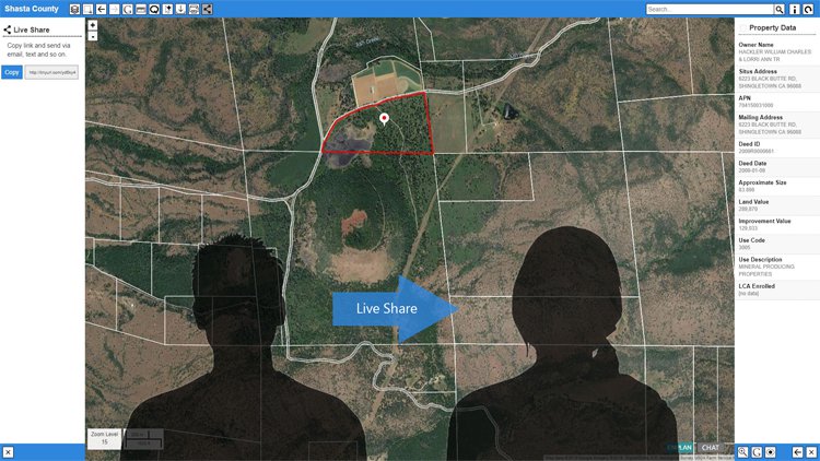
Compiling a map view is the first step in sharing PARCEL VIEWER and property data access. To do this, simply orient the map to provide for an appropriate aerial view of parcel lines defining your parcel(s) of interest or project area. Select parcels individually simply by clicking on them. Select multiple parcels by holding down “Ctrl” and clicking, or by using the box and lasso methods, found under the Advanced Select tool button. These methods cast nets over clusters of parcels as you choose. When selected, the parcel boundaries will be highlighted in yellow, and the assessor parcel numbers will be shown for each in the right panel. An example is shown above.
When the parcel view that you wish to share has been created, sending it to collaborators is extremely simple. Keeping the map in its completed orientation, click the Live Share tool button . The left panel will open containing a short description of the process followed by a GO button. Next, click GO to create a shareable link to your current map view. Then, click Copy (or highlight the link and copy) and share the link as with any other, via email and so on. When the link is opened, the recipients will be inserted into the exact same live view you created and will have access to all the property data, including owner information, as do you.
With Live Share, parcel lines are viewed over aerial imagery equally among you and your collaborators. Sharing the map this way gives you a very effective way to interact and communicate the assets and other characteristics of parcels under examination or consideration. Visual representation is always superior to describing parcels verbally. Nothing will be lost in translation.