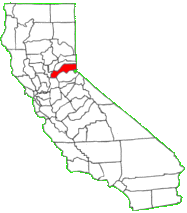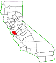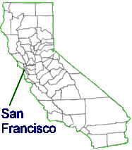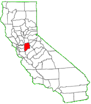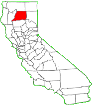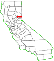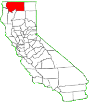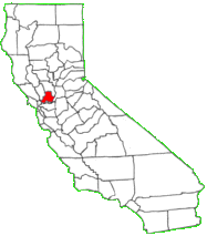
California land parcel research made easy.
Find, browse, view, export and more.
OUR MAP SYSTEM
Parcel Viewer is a web map service specializing in providing property data in an easily digestible format. Our property data is the most current available from each county and updated weekly on our MapPort platform. Parcel or property lines are updated as revised versions become available from each county. All of this is overlayed on the most up-to-date aerial imagery provided by Google.
We have built Parcel Viewer to be the most flexible, intuitive, and user-friendly property data map on the market. We offer a map solution for many industries that is affordable yet rich in relevant data and features. Stop fighting with the unnecessarily complicated interfaces of other web map services and only pay for data within your geographic area of interest.
Day Pass
- Access for 24 hours
Monthly
- Ongoing access
Annual
- Ongoing access, save 17%
Already Have An Account?
Jump right back in by logging in.
WHAT’S INCLUDED
PARCEL DATA
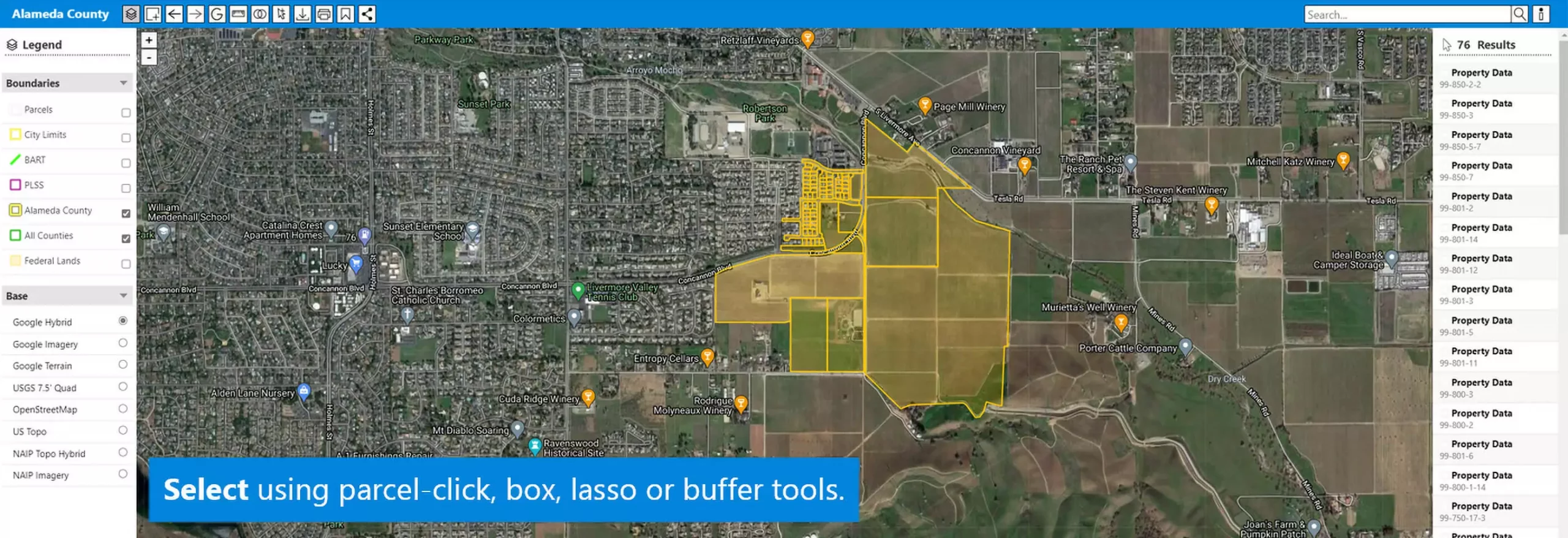
Pan, zoom, and explore parcels and their characteristics with the unique agility of MapPort®. Click on parcels to see owner names and other key information. Download associated data by individual parcel or in batches into CSV files or tables.
See more
-
Owner Name
-
Situs/Street Address
-
Assessor Parcel Number (APN)
-
Owner Mailing Address
-
Approximate Size
-
Year Built
-
Land Value Assessed
-
Improvement Value Assessed
-
Total Value Assessed
-
Deed ID
-
Last Sale
-
Land Use
-
Land Use Code
-
Situs Zip
PROPERTY REPORTS AND DOCUMENTS
View and download reports and documents directly through the map interface. Simply select the parcel of interest in the map and click on the Title Information button in the data panel on the bottom right. A menu will appear where you can read report and document descriptions. From there you can select the item you wish to purchase and download.
See more
-
Grant Deed – Last Transfer Document recorded for the property. $8
example
-
Trust Deed – Last Finance Document recorded for the property. $8
example
-
Property Detail – Ownership, Situs Address, Mailing Address, Location Information, Site Information, Property Characteristics, Assessor Tax Data, Ownership Transfer, Last Market Sale, and Prior Market Sale. $2
example
-
Total View – Provides all the decision-making data you may need, including property, ownership, encumbrance, and market information – plus unique data you won’t find anywhere else. $10
example
-
Transaction History – Comprehensive transaction history details including all ownership transfers such as quit claims and market sales, plus any mortgages including sale or refinance. Additional transactions include Releases, Assignments, and Foreclosure. $10
example
-
Open Lien – Complete details for open mortgage liens, including assignments, and subordinations. $10
example
-
Title Chain and Lien – Most comprehensive and inclusive search available of the owner and property. Gain insight into the property title chain and view all the transactions. – $29
example
-
Property Status Indicator – Know quickly if the property is For Sale, in a HOA, in Default, in Auction, REO, REO Sale, Short Sale, has PACE Lien, has HOA Lien. Each status will provide a True or False as the output. – $2
example
-
Foreclosure – Essential information on properties at all stages of foreclosure and those subject to pending legal action. Detailed data is presented for the most recent Foreclosure Transaction and the Original Mortgage along with Property Characteristic data. $4
example
MAP LAYERS
Our map layers consist of datasets collected from multiple local, state, and federal agencies. From the National Hydrography Dataset (NHD) to the Bureau of Land Management’s (BLM) Federal Lands; we have many datasets to help supplement your parcel research needs.
See more
-
Parcel lines (compiled by individual counties)
-
County boundaries
-
City corporate boundaries/limits
-
Streams and other hydrological features, including canals and pipelines as compiled by the California Department of Water Resources and included in the National Hydrography Dataset (NHD)
-
Watershed boundaries compiled by the USGS
-
Public Land Survey System (PLSS) grid with township, range, and section numbers
-
Federal Lands https://www.doi.gov/blog/americas-public-lands-explained
-
USGS 7.5′ Quad map grid (historic)
-
Federal Emergency Management Agency (FEMA) flood zones and boundaries.
-
Zip codes
BASE LAYERS
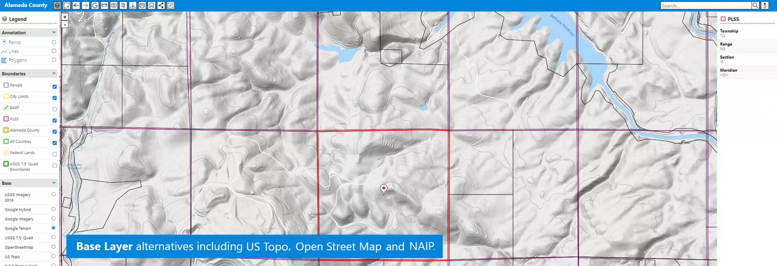
All View parcels over Google Imagery, USGS and other high-quality backdrop layers. All our base layers are obtained directly from the source. Whether it is Google or The National Agriculture Imagery Program (NAIP), we offer multiple high quality basemap layers to help enhance your Parcel Viewer experience.
See more
-
Google Hybrid (with annotation)
-
Google Imagery (plain)
-
Google Terrain
-
OpenStreetMap
-
US Topo feed from USGS
-
USGS 7.5′ Quadrangle (beautiful, seamed, historic)
-
NAIP Imagery and Topo Hybrid (USDA)
TOOLS
Parcel Viewer is designed to maximize user workflow efficiency and quality of experience. We include many tools to help make operation fluid and intuitive.
See more
-
Intelligent Search. Find parcels by assessor parcel number (APN), owner name, or street address using the Elasticsearch engine.
-
Advanced Select. Compile subject parcels and download ownership and other property data instantly.
-
Query. Identify parcels meeting criteria you set using property attributes or data fields.
-
Live Share. Send live map view links lasting two hours.
-
Print and Download. Insert title and print, or save as PDF, or export as PNG.
-
Google Street View. See the nearest street view with a click.
-
Bookmarks. Save your map views. Name and catalog. Reopen with a single click.
-
Metrics. Measure distances and areas. Click points for coordinates.
-
Buffer Select. Compile owner/occupant lists by set distance from subject parcels (with Add-on).
-
Annotation. Create and label points, lines, and polygons. Send links to annotated views using Live Share.
COUNTY DETAILS
Alameda
Population: 1,662,775
Incorporation date: 1853
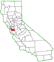
Alameda. County seat, Oakland. Created March 25, 1853. The word Alameda is derived from alamo the Spanish name for cottonwood or poplar tree, and means a “grove of poplar trees.” The name was applied both to the southern portion of the county (La Alameda) and to the stream running through it (Rio de la Alameda) as early as 1795.
Source: California State Association of Counties
Communities:
- Alameda
- Albany
- Berkeley
- Dublin
- Emeryville
- Fremont
- Hayward
- Livermore
- Newark
- Oakland
- Piedmont
- Pleasanton
- San Leandro
- Union City
Alpine
Population:1,141
Incorporation date: 1864
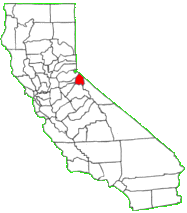
Alpine. County seat, Markleeville. Created March 16, 1864. It derived its name from the English word alpine meaning “of, pertaining to, or connected with, the Alps.” Its geographical position, lying as it does on the crest of the Sierra Nevada mountains, makes it particularly an alpine county, and hence its name.
Communities:
- Alpine Village
- Bear Valley
- Kirkwood
- Markleeville
- Mesavista
- Woodfords
Amador
Population:38,063
Incorporation date: 1854
Amador. County seat, Jackson. Created June 14, 1854. The county is named for Jose Maria Amador, soldier, rancher and miner, who was born in San Francisco in 1794, the son of Sergeant Pedro Amador, a Spanish soldier who settled in California in 1771. In 1848, Jose Maria Amador, with several Indians, established a successful gold mining camp near the present town of Amador. In Spanish, the word amador means “one who loves.”
Source: California State Association of Counties
Communities:
- Amador
- Ione
- Jackson
- Plymouth
- Sutter Creek
Butte
Population 227,837
Incorporation date: 1850
Butter. County seat, Oroville. Created February 18, 1850. Its name is derived from the Marysville or Sutter Buttes, which lay within the boundaries when it was created. The word butte is derived from the Teutonic word meaning “a blunt extension or elevation.” In the French language, it signifies “a small hill or mound of earth detached from any mountain range.”
Source: California State Association of Counties
Communities:
- Biggs
- Chico
- Gridley
- Oroville
- Paradise
Calaveras
Population: 44,637
Incorporation date: 1850
Calaveras. County seat, San Andreas. Created February 18, 1850. The meaning of the word calaveras is “skulls.” This county takes its name from the Calaveras River which was reportedly so designated by an early explorer when he found, on the banks of the stream, many skulls of Indians who had either died of famine or had been killed in tribal conflicts over hunting and fishing grounds.
Source: California State Association of Counties
Communities:
- Angels Camp
- Arnold
- Biggs
- Berry Creek
- Copperopolis
- Forest Meadows
- Forest Ranch
- Murphys
- Rancho Calaveras
- San Andreas
- Valley Springs
- West Point
Colusa
Population: 22,744
Incorporation date: 1850
Colusa. County seat, Colusa. Created February 18, 1850. Named after two Mexican land grants; Coluses (1844) and Colus (1845). The name of the county in the original state legislative act was spelled Colusi, and often in newspapers was spelled Coluse. The word is derived from the name of an Indian tribe living on the west side of the Sacramento River.
Source: California State Association of Counties
Communities:
- Albany
- Arbuckle
- College City
- Colusa
- Colusa Rancheria
- Copperopolis
- Grimes
- Lodoga
- Maxwell
- Princeton
- Stonyford
- Williams
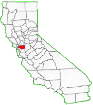
Contra Costa
Population: 1,145,876
Incorporation date: 1850
Contra Costa. County seat, Martinez. Created February 18, 1850. The name signifies “opposite coast,” because of its situation opposite San Francisco, in an easterly direction, on San Francisco Bay. In 1853, Alameda County was formed from territory originally included in this county.
Source: California State Association of Counties
Communities:
- Antioch
- Brentwood
- Clayton
- Concord
- Danville
- El Cerrito
- Hercules
- Lafayette
- Martinez
- Moraga
- Oakley
- Orinda
- Pinole
- Pittsburg
- Pleasant Hill
- Richmond
- San Pablo
- San Ramon
- Walnut Creek
Del Norte
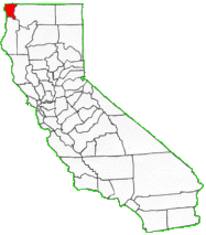
Population: 27,275
Incorporation date: 1857
Del Norte. County seat, Crescent City. Created March 2, 1857, from territory formerly included in Klamath County. The name of this county signifies “the north” and the county derived its name from its geographical position in the extreme northwest corner of the state.
Source: California State Association of Counties
Communities:
- Bertsch-Oceanview
- Crescent City
- Elk River Rancheria
- Gasquet
- Hiouchi
- Klamath
- Smith River
- Smith River Rancheria
- Yurok Reservation
El Dorado
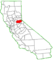
Population: 188,993
Incorporation date: 1850
El Dorado. County seat, Placerville. Created February 18, 1850. El Dorado — the far-famed fabulous region of genial clime and never-fading verdure, where gold and precious stones are as common as rocks and pebbles, where wines gently flow from fountains. The name, meaning “the gilded one” in Spanish, appears at the beginning of the 16th century as that of a mythical Indian chief who was said to have been covered with gold dust during the performance of religious rites. When the discovery of gold by James W. Marshall at Coloma in January 1848 became known to the world, California, and particularly that section where gold was discovered, was called “El Dorado.” From this fact the county received its name.
Communities:
- Auburn Lake Trails
- Cameron Park
- Camino
- Diamond Springs
- El Dorado Hills
- Placerville
- Pollock Pines
- Shingle Springs
- South Lake Tahoe
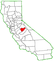
Fresno
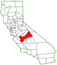
Population: 1,010,926
Incorporation date: 1856
Fresno. County seat, Fresno. Created April 19, 1856. Named after Fresno Creek. Fresno in Spanish signifies “ash tree” and it was due to the abundance of mountain ash or ash trees in the county that it received its name.
Source: California State Association of Counties
Communities:
- Clovis
- Coalinga
- Firebaugh
- Fowler
- Fresno
- Huron
- Kerman
- Kingsburg
- Mendota
- Orange Cove
- Parlier
- Reedley
- Sanger
- San Joaquin
- Selma
Glenn
Population: 29,337
Incorporation date: 1891
Glenn. County seat, Willows. Created March 11, 1891. The county was created out of the northern portion of Colusa County and was named for Dr. Hugh J. Glenn, who was the largest wheat farmer in the state during his lifetime, and a man of great prominence in political and commercial life in California.
Source: California State Association of Counties
Communities:
- Artois
- Elk Creek
- Grindstone Rancheria
- Hamilton City
- Orland
- Willows
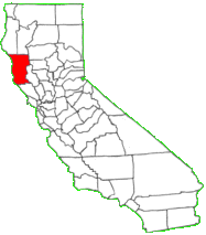
Humboldt
Population: 135,627
Incorporation date: 1853
Humboldt. County seat, Eureka. Created May 12, 1853. The county derived its name from Humboldt Bay which was entered by a sea otter party in 1806, but was not rediscovered until 1849. In 1850, Douglas Ottinger and Hans Buhne entered the bay, naming it Humboldt in honor of the great naturalist and world explorer, Baron Alexander von Humboldt.
Source: California State Association of Counties
Communitites:
- Arcata
- Blue Lake
- Eureka
- Ferndale
- Fortuna
- Rio Dell
- Trinidad
Imperial
Population: 189,468
Incorporation date: 1907
Imperial. County seat, El Centro. Created August 15, 1907. It derived its name from the Imperial Valley and is the “youngest” of California’s counties. The valley was named for the Imperial Land Company, a subsidiary of the California Development Company, which at the turn of the century had reclaimed the southern portion of the Colorado desert for agriculture.
Source: California State Association of Counties
Communitites:
- Brawley
- Calexico
- Calipatria
- El Centro
- Holtville
- Imperial
- Westmorland
Inyo
Population: 18,526
Incorporation date: 1866
Inyo. County seat, Independence. Created March 22, 1866. This county derived its name from the Indian name for the mountains in its area. The meaning of the word Inyo is “dwelling place of the great spirit.”
Source: California State Association of Counties
Communitites:
- Bishop
Kern
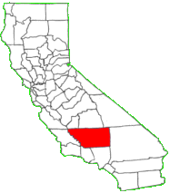
Population: 907,518
Incorporation date: 1866
Kern. County seat, Bakersfield. Created April 2, 1866. The county derived its name from the Kern River which was named for Edward Kern, topographer of General John C. Fremont’s 1845 expedition.
Source: California State Association of Counties
Communitties:
- Arvin
- Bakersfield
- California City
- Delano
- Maricopa
- Mcfarland
- Ridgecrest
- Shafter
- Taft
- Tehachapi
- Wasco
Kings
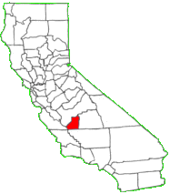
Population: 153,540
Incorporation date: 1893
Kings. County seat, Hanford. Created March 22, 1893. The county was created out of a part of Tulare County; some 100 square miles of territory from Fresno County was added in 1908. It derived its name from the Kings River which, according to Padre Munoz’ diary of the Moraga Expedition of 1806, was discovered in 1805 by an exploring expedition and named Rio de los Santos Reyes (River of the Holy Kings).
Source: California State Association of Counties
Communities:
- Avenal
- Corcoran
- Hanford
- Lemoore
Lake
Population: 65,170
Incorporation date: 1861
Lake. County seat, Lakeport. Created May 20, 1861, from territory formerly included in Napa County. This county derived its name because of the many charming lakes in the area, most prominently Clear Lake.
Source: California State Association of Counties
Communities:
- Clearlake
- Clearlake Oaks
- Clearlake Riviera
- Hidden Valley Lakes
- Kelseyville
- Lakeport
- Lucerne
- Nice
- North Lakeport
Lassen
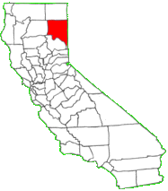
Population: : 30,563
Incorporation date: 1864
Lassen. County seat, Susanville. Created April 1, 1864. The county’s name was derived from Mount Lassen which was named for Peter Lassen, one of General Fremont’s guides and a famous trapper, frontiersman and Indian fighter. He was murdered under mysterious circumstances near the Black Rock Desert in 1859, and his murder was never solved.
Source: California State Association of Counties
Communities:
- Bieber
- Doyle
- Herlong
- Janesville
- Johnstonville
- Lichfield
- Patton Village
- Susanville
- Westwood
Los Angeles
Population: 10,278,836
Incorporation date: 1850
Los Angeles. County seat, Los Angeles. Created February 18, 1850. The words los angeles literally mean “the angels” and are a contraction of the original name Pueblo del Rio de Nuestra Senora la Reina de Los Angeles de Porciuncula (the Town of the River of Our Lady, Queen of the Angeles). In 1781, Governor Felipe de Neve issued orders for the establishment of the pueblo on El Rio Nuestra Senora de Los Angeles. The pueblo in time became known as the Ciudad de Los Angeles (City of the Angels), and it is from this contraction that the present name is derived.
Source: California State Association of Counties
Communities:
- Agoura Hills
- Alhambra
- Arcadia
- Artesia
- Avalon
- Azusa
- Baldwin Park
- Bell
- Bellflower
- Bell Gardens
- Beverly Hills
- Bradbury
- Burbank
- Calabasas
- Carson
- Cerritos
- Claremont
- Commerce
- Compton
- Covina
- Cudahy
- Culver City
- Diamond Bar
- Downey
- Duarte
- El Monte
- El Segundo
- Gardena
- Glendale
- Glendora
- Hawaiian Gardens
- Hawthorne
- Hermosa Beach
- Hidden Hills
- Huntington Park
- Industry
- Inglewood
- Irwindale
- La Canada Flintridge
- La Habra Heights
- Lakewood
- La Mirada
- Lancaster
- La Puente
- La Verne
- Lawndale
- Lomita
- Long Beach
- Los Angeles
- Lynwood
- Malibu
- Manhattan Beach
- Maywood
- Monrovia
- Montebello
- Monterey Park
- Norwalk
- Palmdale
- Palos Verdes Estates
- Paramount
- Pasadena
- Pico Rivera
- Pomona
- Rancho Palos Verdes
- Redondo Beach
- Rolling Hills
- Rolling Hills Estates
- Rosemead
- San Dimas
- San Fernando
- San Gabriel
- San Marino
- Santa Clarita
- Santa Fe Springs
- Santa Monica
- Sierra Madre
- Signal Hill
- South El Monte
- South Gate
- South Pasadena
- Temple City
- Torrance
- Vernon
- Walnut
- West Covina
- West Hollywood
- Westlake Village
- Whittier
Madera
Population: 158,259
Incorporation date: 1893
Madera. County seat, Madera. Created March 11, 1893, from a portion of Fresno County lying north of the San Joaquin River. Madera in Spanish signified “timber.” The county derived its name from the town of Madera, named when the California Lumber Company built a flume to carry lumber to the railroad there in 1876.
Source: California State Association of Counties
Communities:
- Ahwahnee
- Bass Lake
- Chowchila
- Coarsegold
- Madera
- North Fork
- Oakhurst
- O Neals
- Raymond
Marin
Population: 262,224
Incorporation date: 1850
Marin. County seat, San Rafael. Created February 18, 1850. The origin of its name is not clear. One version is the county was named for Chief Marin, of the Licatiut tribe of Indians who inhabited that section and waged fierce battle against the early Spanish military explorers. The other version is that the bay between San Pedro and San Quentin points was named Bahia de Nuestra Senora del Rosario la Marinera by Ayala in 1775, and it is quite possible that Marin is simply an abbreviation of this name.
Source: California State Association of Counties
Communities:
- Belvedere
- Corte Madera
- Fairfax
- Larkspur
- Mill Valley
- Novato
- Ross
- San Anselmo
- San Rafael
- Sausalito
- Tiburon
Mariposa
Population: 17,918
Incorporation date: 1850
Mariposa. County seat, Mariposa. Created February 18, 1850. The county took its name from Mariposa Creek. The area was so named by Spanish explorers in 1807 when they discovered great clusters of butterflies (“mariposas” in Spanish) in the foothills of the Sierras. Some say these butterflies were really butterfly lilies.
Source: California State Association of Counties
Communities:
- Mariposa
- Midpnes
- Lake Don Pedro
- Yosemite
- Bootjack
Mendocino
Population: 89,027
Incorporation date: 1850
Mendocino. County seat, Ukiah. Created February 18, 1850. The county derived its name from Cape Mendocino which was probably named in honor of either Antonio de Mendoza, Viceroy of New Spain, 1535-1542 (who sent the Juan Cabrillo Expedition to this coast in 1542), or Lorenzo Suarez de Mendoza, Viceroy from 1580 to 1583. Mendocino is an adjective form of the family name of Mendoza.
Source: California State Association of Counties
Communities:
- Fort Bragg
- Point Arena
- Ukiah
- Willits
Merced
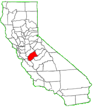
Population: 280,772
Incorporation date: 1855
Merced. County seat, Merced. Created April 19, 1855, from a part of Mariposa County. The county derived its name from the Merced River of El Rio de Nuestra Senora de la Merced (River of Our Lady of Mercy); named in 1806 by an expedition, headed by Gabriel Moraga, which came upon it at the end of a hot dusty ride.
Source: California State Association of Counties
Communities:
- Atwater
- Dos Palos
- Gustine
- Livingston
- Los Banos
- Merced
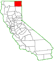
Modoc
Population: 9,505
Incorporation date: 1874
Modoc. County seat, Alturas. Created February 17, 1874, from an eastern section of Siskiyou county. It derived its name from a fierce Indian tribe which lived at the Pit River headwaters. One historian suggests that the word modoc means “the head of the river.” Another states that the word is derived from the Klamath word moatakni meaning “southerners,” i.e., the people living south of the Klamath tribe.
Source: California State Association of Counties
Communities:
- Adin
- Alturas
- California Pines
- Canby
- Cedarville
- Daphnedale
- Lookout
- Newell
- New Pine Creek
Mono
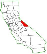
Population: 13,887
Incorporation date: 1861
Mono. County seat, Bridgeport. Created April 24, 1861. The county is named after Mono Lake which, in 1852, was named for an Indian tribe that inhabited the Sierra Nevada from north of Mono Lake to Owens Lake. The tribe’s western neighbors, the Yokuts, called them monachie meaning “fly people” because the pupae of a fly was their chief food staple and trading article.
Source: California State Association of Counties
Communities:
- Benton
- Bridgeport
- Chalfant
- Coleville
- Crowley Lake
- June Lake
- Lee Vining
- Mammoth Lakes
- Walker
Monterey
Population: 443,819
Incorporation date: 1850
Monterey. County seat, Salinas. Created February 18, 1850. It derived its name from the Bay of Monterey. The word itself is composed of the Spanish words monte and rey, and literally means “king of the forest.” The bay was named by Sebastian Vizcaino in 1602, in honor of the Conde de Monterey, the Viceroy of New Spain.
Source: California State Association of Counties
Communities:
- Carmel-By-The-Sea
- Del Rey Oaks
- Gonzales
- Greenfield
- King City
- Marina
- Monterey
- Pacific Grove
- Salinas
- Sand City
- Seaside
- Soledad
Napa
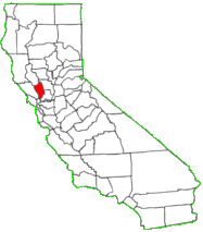
Population: 140,491
Incorporation date: 1850
Napa. County seat, Napa. Created February 18, 1850. Named after Napa Valley. The word napa is of Indian derivation and has been variously translated as “grizzly bear,” “house,” “motherland” or “fish.” Of the many explanations of the names’s origin, the most plausible seems to be that it is derived from the Patwin word napo meaning house.
Source: California State Association of Counties
Communities:
- American Canyon
- Calistoga
- Napa
- St Helena
- Yountville
Nevada
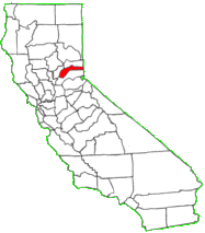
Population: 98,719
Incorporation date: 1851
Nevada. County seat, Nevada City. Created April 25, 1851. Named after the mining town of Nevada City, a name derived from the term “Sierra Nevada.” The word nevada in Spanish means “snowy” or “snowcovered.”
Source: California State Association of Counties
Communities:
- Grass Valley
- Nevada City
- Truckee
Orange
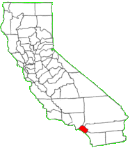
Population: 3,216,817
Incorporation date: 1889
Orange. County seat, Santa Ana. Created March 11, 1889. This county was given the name of Orange to sound like a semi-tropical paradise in order to encourage immigration.
Source: California State Association of Counties
Communities:
- Aliso Viejo
- Anaheim
- Brea
- Buena Park
- Costa Mesa
- Cypress
- Dana Point
- Fountain Valley
- Fullerton
- Garden Grove
- Huntington Beach
- Irvine
- Laguna Beach
- Laguna Hills
- Laguna Niguel
- Laguna Woods
- La Habra
- Lake Forest
- La Palma
- Los Alamitos
- Mission Viejo
- Newport Beach
- Orange
- Placentia
- Rancho Santa Margarita
- San Clemente
- San Juan Capistrano
- Santa Ana
- Seal Beach
- Stanton
- Tustin
- Villa Park
- Westminster
- Yorba Linda
Placer
Population: 389,047
Incorporation date: 1851
Placer. County seat, Auburn. Created April 25, 1851. Placer is probably a contraction of the words plaza de oro (the place of gold) and in Spanish means “a place near a river where gold is found.” The county derived its name from the numerous places where the method of extracting gold from the earth, called placer mining, was practiced.
Source: California State Association of Counties
Communities:
- Auburn
- Colfax
- Lincoln
- Loomis
- Rocklin
- Roseville
Plumas
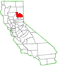
Population: 19,517
Incorporation date: 1854
Plumas. County seat, Quincy. Created March 18, 1854. The Spanish originally called one of the tributaries of the Sacramento River El Rio de las Plumas or the “River of Feathers.” The Legislature, in creating this county, gave it the name Plumas because all of the numerous branches of the Feather River have their origins in its mountains.
Communities:
- Chester
- Delleker
- Graegle
- Greenville
- Hamilton Branch
- Lake Almanor
- Meadow Valley
- Portola
- Quincy
Riverside
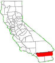
Population: 2,419,897
Incorporation date: 1893
Riverside. County seat, Riverside. Created March 11, 1893. This county was created from portions of San Diego and San Bernardino counties and derived its name from the City of Riverside, christened when the upper canal of the Santa Ana River reached it in 1871.
Source: California State Association of Counties
Communitites:
- Banning
- Beaumont
- Blythe
- Calimesa
- Canyon Lake
- Cathedral City
- Coachella
- Corona
- Desert Hot Springs
- Eastvale
- Hemet
- Indian Wells
- Indio
- Jurupa Valley
- Lake Elsinore
- La Quinta
- Menifee
- Moreno Valley
- Murrieta
- Norco
- Palm Desert
- Palm Springs
- Perris
- Rancho Mirage
- Riverside
- San Jacinto
- Temecula
- Wildomar
Sacramento
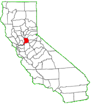
Population: 1,534,893
Incorporation date: 1850
Sacramento. County seat, Sacramento. Created February 18, 1850. The county was named by Captain Moraga after the Sacramento River. The word sacramento signifies “Sacrament” or “Lord’s Supper.”
Source: California State Association of Counties
Communities:
- Citrus Heights
- Elk Grove
- Folsom
- Galt
- Isleton
- Rancho Cordova
- Sacramento
San Benito
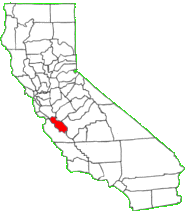
Population: 61,260
Incorporation date: 1874
San Benito. County seat, Hollister. Created February 12, 1874. Named after San Benito Valley. Crespi, in his expedition in 1772, named a small river in honor of San Benidicto (Saint Benedict), the patron saint of the married, and it is from the contraction of this name that the county took its name.
Communities:
- Hollister
- San Juan Bautista
San Bernardino
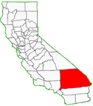
Population: 2,178,492
Incorporation date: 1853
San Bernardino. County seat, San Bernardino. Created April 26, 1853. Saint Bernard is the patron saint of mountain passes. The name Bernardino means “bold as a bear.” The Spanish gave the name San Bernardino to the snowcapped peak in southern California, in honor of the saint; from him the county derived its name.
Source: California State Association of Counties
Communities:
- Adelanto
- Apple Valley
- Barstow
- Big Bear Lake
- Chino
- Chino Hills
- Colton
- Fontana
- Grand Terrace
- Hesperia
- Highland
- Loma Linda
- Montclair
- Needles
- Ontario
- Rancho Cucamonga
- Redlands
- Rialto
- San Bernardino
- Twentynine Palms
- Upland
- Victorville
- Yucaipa
- Yucca Valley
San Diego
Population: 3,344,430
Incorporation date: 1850
San Diego. County seat, San Diego. Created February 18, 1850. Named after San Diego Bay, which had been rechristened by Vizcaino in 1602, in honor of the Franciscan, San Diego de Alcala de Henares, whose name was borne by his flagship.
Source: California State Association of Counties
Communities:
- Carlsbad
- Chula Vista
- Coronado
- Del Mar
- El Cajon
- Encinitas
- Escondido
- Imperial Beach
- La Mesa
- Lemon Grove
- National City
- Oceanside
- Poway
- San Diego
- San Marcos
- Santee
- Solana Beach
- Vista
San Francisco
Population: 887,540
Incorporation date: 1850
San Francisco. County seat, San Francisco. Created February, 18, 1850. The sixth mission in California was established here by Padre Junipero Serra on October 9, 1776, and was named Mission San Francisco de Asis a la Laguna de los Dolores (Saint Francis of Assisi at the Lagoon of Sorrows). The mission is now known as “Mission Dolores.”
San Joaquin
Population: 759,186
Incorporation date: 1850
San Joaquin. County seat, Stockton. Created February 18, 1850. The county takes its name from the San Joaquin River. In the early 1800’s Lieutenant Moraga, commanding an expedition in the lower great Central Valley of California, gave the name of San Joaquin (meaning Saint Joachim) to a rivulet that springs from the Sierra Nevada mountains and empties into Buena Vista Lake.
Source: California State Association of Counties
Communities:
- Escalon
- Lathrop
- Lodi
- Manteca
- Ripon
- Stockton
- Tracy
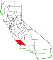
San Luis Obispo
Population: 279,370
Incorporation date: 1850
San Luis Obispo. County seat, San Luis Obispo. Created February 18, 1850. In 1772, the Mission San Luis Obispo was established here by Padre Junipero Serra and named for Saint Luis, the Bishop of Toulouse. The county’s name comes from the mission.
Source: California State Association of Counties
Communities:
- Arroyo Grande
- Atascadero
- El Paso De Robles
- Grover Beach
- Morro Bay
- Pismo Beach
- San Luis Obispo
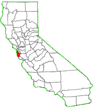
San Mateo
Population: 766,041
Incorporation date: 1856
San Mateo. County seat, Redwood City. Created April 19, 1856. The county bears the Spanish name for Saint Matthew. As a place name, St. Matthew appears as early as 1776, and the arroyo, the point and the settlement at the unofficial San Mateo Mission are all so designated on the early maps. Until about 1850, the name appeared as San Matheo.
Source: California State Association of Counties
Communities:
- Atherton
- Belmont
- Brisbane
- Burlingame
- Colma
- Daly City
- East Palo Alto
- Foster City
- Half Moon Bay
- Hillsborough
- Menlo Park
- Millbrae
- Pacifica
- Portola Valley
- Redwood City
- San Bruno
- San Carlos
- San Mateo
- South San Francisco
- Woodside
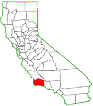
Santa Barbara
Population: 446,717
Incorporation date: 1850
Santa Barbara. County seat, Santa Barbara. Created February 18, 1850. The Santa Barbara Channel received its name from Sebastian Vizcaino when he sailed over the channel waters in 1602. In 1782, Padre Junipero Serra dedicated a site near the channel for a presidio and on December 4, 1786, he founded the nearby Mission Santa Barbara (Saint Barbara). The county derives its name from the mission.
Source: California State Association of Counties
Communities:
- Buellton
- Carpinteria
- Goleta
- Guadalupe
- Lompoc
- Santa Barbara
- Santa Maria
- Solvang
Santa Clara
Population: 1,927,888
Incorporation date: 1850
Santa Clara. County seat, San Jose. Created February 18, 1850. The county is named after Mission Santa Clara, which was established in 1777, and named for Saint Clara of Assisi, Italy. The name Clara means “clear” or “bright.”
Source: California State Association of Counties
Communities:
- Campbell
- Cupertino
- Gilroy
- Los Altos
- Los Altos Hills
- Los Gatos
- Milpitas
- Monte Sereno
- Morgan Hill
- Mountain View
- Palo Alto
- San Jose
- Santa Clara
- Saratoga
- Sunnyvale
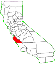
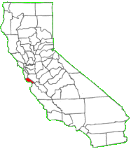
Santa Cruz
Population: 275,902
Incorporation date: 1850
Santa Cruz. County seat, Santa Cruz. Created February 18, 1850. In the original act, the county was given the name of Branciforte after the Spanish pueblo founded there in 1797. Less than two months later, the name was changed to Santa Cruz. The Santa Cruz Mission, established in 1791 and completed in 1794, was destroyed by earthquake in 1857, but a smaller-scale replica was erected in 1931. Santa Cruz signifies “holy cross.”
Source: California State Association of Counties
Communities:
- Capitola
- Santa Cruz
- Scotts Valley
- Watsonville
Shasta
Population: 178,592
Incorporation date: 1850
Shasta. County seat, Redding. Created February 18, 1850. This county was named after Mount Shasta, the name Shasta is derived from the English equivalent for the name of an Indian tribe that once lived in the area. The name of the tribe was spelled in various ways until the present version was used when the county was established.
Source: California State Association of Counties
Communities:
- Anderson
- Bella Vista
- Burney
- Cottonwood
- Lakehead
- Millville
- Mountain Gate
- Palo Cedro
- Redding
- Shasta
- Shasta Lake
- Shingletown
Sierra
Population: 3,203
Incorporation date: 1850
Sierra. County seat, Downieville. Created April 16, 1852. Sierra nevada in Spanish means “snow saw,” applied to the Sierra Nevada mountain chain because of the jagged, serrated, sawtooth peaks forming the skyline.
Source: California State Association of Counties
Communities:
- Calpine
- Downieville
- Loyalton
- Sierra Brooks
- Sierra City
- Sierraville
- Verdi
Siskiyou
Population: 44,739
Incorporation date: 1852
Siskiyou. County seat, Yreka. Created March 22, 1852, and named after the mountain range. The origin of the word siskiyou is not known. One version is that it is the Chinook Indian word for “bob-tailed horse.” Another version, given in an argument before the state Senate in 1852, is that the French name Six Callieux, meaning “six-stone,” was given to a ford on the Umpqua River by Michel La Frambeau and a party of Hudson’s Bay company trappers in 1832, because six large stones or rocks lay in the river where they crossed. Still others attribute the name to a local tribe of Indians.
Communities:
- Dorris
- Dunsmuir
- Etna
- Fort Jones
- Montague
- Mount Shasta
- Tulelake
- Weed
- Yreka
Solano
Population: 431,498
Incorporation date: 1850
Solano. County seat, Fairfield. Created February 18, 1850. The county derives its name indirectly from that of the Franciscan missionary, Father Francisco Solano, whose name was given in baptism to the chief of one of the Indian tribes of the region. Before receiving the name Solano, the chief was called Sem-yeto, which signifies “brave or fierce hand.” At the request of General Mariano Vallejo, the county was named for Chief Solano, who at one time ruled over most of the land and tribes between the Petaluma Creek and the Sacramento River.
Source: California State Association of Counties
Communities:
- Benicia
- Dixon
- Fairfield
- Rio Vista
- Suisun City
- Vacaville
- Vallejo
Sonoma
Population: 501,959
Incorporation date: 1850
Sonoma. County seat, Santa Rosa. Created February 18, 1850. Sonoma is a Chocuyen Indian name translated by some as “Valley of the Moon” and by others as “land or tribe of the Chief Nose.”
Source: California State Association of Counties
Communities:
- Cloverdale
- Cotati
- Healdsburg
- Petaluma
- Rohnert Park
- Santa Rosa
- Sebastopol
- Sonoma
- Windsor
Stanislaus
Population: 540,214
Incorporation date:
Stanislaus. County seat, Modesto. Created April 1, 1854. The word Stanislaus is a corruption of Estanislao, the baptismal name of a mission-educated renegade Indian chief who led a band of Indians in a series of battles against Mexican troops. He was finally defeated by General Mariano G. Vallejo in 1826. The county is named for the Stanislaus River, first discovered by Gabriel Moraga in 1806, and later renamed Rio Estanislao for the Indian chief.
Source: California State Association of Counties
Communities:
- Ceres
- Hughson
- Modesto
- Newman
- Oakdale
- Patterson
- Riverbank
- Turlock
- Waterford
Sutter
Incorporation date: 1850
Sutter. County seat, Yuba City. Created February 18, 1850. Sutter County was named after General John Augustus Sutter, a native of Switzerland, who obtained a large land grant from the Mexican government, and called his first settlement New Helvetia (now the City of Sacramento). In 1841, the general established a great stock ranch in this area to which he retired in 1850 when gold seekers deprived him of most of his holdings at Sacramento.
Source: California State Association of Counties
Communities:
- East Nicolaus
- Live Oak
- Meridian
- Nicolaus
- Rio Oso
- Robbins
- Sutter
- Trowbridge
- Yuba City
Tehama
Population: 63,934
Incorporation date: 1856
Tehama. County seat, Red Bluff. Created April 9. 1856. The county is named for the City of Tehama. Suggested possible roots are the Arabic word tehama (“hot low-lands”), the Mexican word tejamanil (shingle), or “high water” in the dialect of local Indians.
Source: California State Association of Counties
Communities:
- Corning
- Red Bluff
- Tehama
Trinity
Population: 13,667
Incorporation date: 1850
Trinity. County seat, Weaverville. Created February 18, 1850. It takes its name from the Trinity River, named in 1845 by Major Pearson B. Reading who was under the mistaken impression that the stream emptied into Trinidad Bay. Trinity is the English version of Trinidad.
Source: California State Association of Counties
Communities:
- Burnt Ranch
- Douglas City
- Hayfork
- Junction City
- Lewiston
- Mad River
- Ruth
- Trinity Village
- Weaverville
Tulare
Population: 466,339
Incorporation date: 1852
Tulare: County seat, Visalia. Created April 20, 1852. Commandante Fages, while hunting for deserters in 1772, discovered a great lake surrounded by marshes and filled with rushes which he named Los Tules (the tules). It is from this lake that the county derives its name. The root of the name Tulare is found in the Mexican word tullin, designating cattail or similar reeds.
Source: California State Association of Counties
Communities:
- Dinuba
- Exeter
- Farmersville
- Lindsay
- Porterville
- Tulare
- Visalia
- Woodlake
Tuolumne
Population: 54,900
Incorporation date: 1850
Tuolome. County seat, Sonora. Created February 18, 1850. The name Tuolumne is of Indian origin and has been given different meanings, such as Many Stone Houses, The Land of Mountain Lions and Straight Up Steep, the later an interpretation of William Fuller, a native Indian Chief. Vallejo, in his report to the first Legislature, said that the word is “a corruption of the Indian word talmalamne which signifies “cluster of stone wigwams.” The name may mean “people who dwell in stone houses,” i.e., in caves.
Source: California State Association of Counties
Communities:
- Cedar Ridge
- Columbia
- East Sonora
- Jamestown
- Mi-Wuk Village
- Mono Vista
- Phoenix Lake
- Pine Mountain Lake
- Sonora
- Soulsbyville
- Tuolumne City
- Twain Harte
Ventura
Population: 856,508
Incorporation date: 1872
Ventura. County seat, Ventura. Created March 22, 1872. In 1782 the Mission San Buenaventura was founded as San Buenaventura (now known as Ventura). Buenaventura is composed of two Spanish words, buena meaning “good” and ventura meaning “fortune.”
Source: California State Association of Counties
Communities:
- Camarillo
- Fillmore
- Moorpark
- Ojai
- Oxnard
- Port Hueneme
- Santa Paula
- Simi Valley
- Thousand Oaks
- Ventura
Yolo
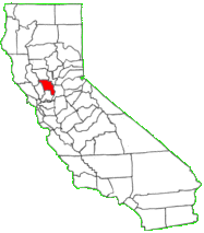
Population: 214,555
Incorporation date: 1850
Yolo. County seat, Woodland. Created February 18, 1850. In the original act of 1850 the name was spelled “Yola.” Yolo is an Indian name variously believed to be a corruption of an Indian tribal name Yo-loy meaning “a place abounding in rushes” or of the name of the Indian chief, Yodo, or of the Indian village of Yodoi.
Source: California State Association of Counties
Communities:
- David
- Plumas Lake
- West Sacramento
- Wheatland
- Winters
- Woodlands
Yuba
Population: 74,345
Incorporation date: 1850
Yuba. County seat Marysville. Created February 18, 1850. It was named after the Yuba River by Captain John A. Sutter for the Indian village Yubu, Yupu or Juba near the confluence of the Yuba and Feather rivers. Vallejo stated that the river was named Uba by an exploring expedition in 1824 because of the quantities of wild grapes (uvas silvestres in Spanish) which they found growing on its banks.
Source: California State Association of Counties
Communities:
- Camptonville
- Challenge-Brownsville
- Dobbins
- Linda
- Loma Rica
- Marysville
- Olivehurst
- Plumas Lake
- Wheatland
MOBILE APP
Property data, parcel lines, search, and blue dot GPS location in the palm of your hand! Our MapPort mobile app is available for all devices.
SUPPORT
Get prompt assistance 9-5 Pacific time, Monday-Friday via phone or email. We are eager to help.
wmsgroup@enplan.com | (530) 402-4783
Existing client? Log in and click Add Services.
Standard Maps: $49/month | $490/year | $15 Day Pass
Custom Maps: Contact us
MORE OPTIONS
Extend the effectiveness of Parcel Viewer by adding functionalities and other data you may need. If you do not see what you would like, please tell us what you envision. Our team loves solving real-world problems for clients.
COLLABORATOR SEATS
Extend map access to others. Perfect for organizations or groups.
$20/seat/month or $220 /seat/year.
-
Each SEAT allows another user to be logged in at one time.
-
Extend access to an unlimited number of users via simple email invitation.
-
The Administrator (you or whoever is assigned) always has access.
-
Users manage their own login credentials.
-
Control invited user access through the Administrator dashboard.
-
Collaborator Seats work across all your ENPLAN PV maps.
Add Collaborator Seats when you sign up or log in later and click Get Maps & Add-ons.
OUTREACH
Compile owner data and print mailing labels.
$20/month or $220/year.
-
Select by set distance (buffer) from subject parcels as well as other methods.
-
Download to tables or spreadsheets, or print mail labels directly.
-
Save/print views of parcels whose owners are selected for mail notifications.
-
Easily comply with hearing notification and sensitive use siting requirements.
-
Works seamlessly across all your ENPLAN PV maps.
Add outreach when you sign up or log in and click Get Maps & Add-ons.
CUSTOM MAPS
Do you or your organization need special data incorporated in your PV map? Our team can make a Custom Map instance for you based on PV and add the data needed. All PV functionalities and data remain intact, including automated feeds such as weekly property data refreshment. Custom Maps are completely secure and can be made fully accessible by others at your discretion with the addition of Collaborator Seats. Data added can be proprietary as well as from other sources, private or public.
A Custom Map enables viewing your data in spatial relation to other map data layers. For example, view your data layers in relation to land ownership, government jurisdiction, FEMA flood zones, liquefaction zones, topography, and so on. Information can be attached to your features and viewed by simply clicking to open the data panel. Or select your features in multiples and download attached data into spreadsheets or tables. Make mailing labels for property owners you wish to contact. Annotate your map feature layers and share live via Live Share. Functionalities and your data will also be accessible in the field via tablet or phone using the MapPort app.
The possibilities with custom maps are many and best understood by speaking with a MapPort team member about your objectives. “Spin-up” of custom maps can be very fast. wmsgroup@enplan.com or (530) 402-4783
MapPort® is a web map services platform created by ENPLAN.
Privacy Policy Terms of Service
wmsgroup@enplan.com (530) 402-4783

