Powerful USGS basemaps incorporated
 The United States Geologic Survey (USGS) has created rich geographic information for nearly a century and a half. Now the ENPLAN Parcel Viewer (PV) incorporates two of the most valuable USGS basemaps – USGS 7.5’ Quad and US Topo. These complimentary basemaps provide an invaluable resource for Parcel Viewer clients who are interested in classic topographic and planimetric characteristics of land parcels.
The USGS 7.5’ Quad is the United States Geologic Survey legacy map medium. Begun in 1884, USGS Quad maps quickly became a staple for settlers, surveyors, planners, and explorers in an expanding nation. These hand-drawn and field inspected maps provide clear, detailed, elevation and landcover information. Intuitive symbology and extensive labeling make features such as aqueducts, wells, notable buildings, peaks, and roads clearly distinguishable. In-map graticules delineate latitude and longitude. In conjunction with the PV parcel geometry overlay, the 7.5’ Quad base makes it possible to discern a parcel’s historic use and topographic context.
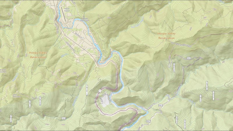
In 2009, 7.5’ Quad updates were discontinued and the current generation of USGS topographic maps published as digital US Topo was initiated. The less time intensive process allows the map to be more regularly updated. New editions are published annually in contrast to the sporadic and infrequent updates of the 7.5’ Quad. This means that the US Topo basemap in Parcel Viewer will always provide the most current geographic data available.
US Topo also marks a major stylistic update from the 7.5’ Quad. Subtler pastel colors replace the saturated shades of the previous map. Building symbology and shaded relief are added, while removing extraneous labels. These changes make reading topography much more intuitive and provide a cleaner visual appearance. As a result, US Topo is the hands-down best available geographic data basemap.
Together, these two basemaps make Parcel Viewer a powerful tool for any project involving new uses of a parcel. With a total of eight available basemaps, including high resolution Google and NAIP imagery, Parcel Viewer offers the best property analysis and use planning options for any user. And with PV, users will be rove-ready to where mobile broadband does not extend when ENPLAN’s new MapPort mobile device app is released.